![]()
![]()
![]()
The 14th Generation International Geomagnetic Reference Field (IGRF) implemented as an R package. The igrf package provides an R version of the of the original IGRF model in Fortran published by Alken et al. 2021 (available on the NOAA website https://www.ncei.noaa.gov/products/international-geomagnetic-reference-field). R outputs have been verified to correspond with the original Fortran code and can be considere equivalent with the exception that values in the R are not rounded before output. For all intents and purposes the data can be considered equivalent.
For full model details I refer to Alken et al. 2021, and the project website where both the original code and a brief model description can be found. The authors of both the R package and the original Fortran code take no responsibility regarding the use of these data within a professional context. For caveats on model use I refer to the health warning on the original project website (https://www.ncei.noaa.gov/products/international-geomagnetic-reference-field/health-warning).
How to cite this package in your article
Koen Hufkens. (2022). bluegreen-labs/igrf: IGRF CRAN release v1.0 (v1.0). Zenodo. https://doi.org/10.5281/zenodo.6527638
Installation
stable release
To install the current stable release use a CRAN repository:
install.packages("igrf")
library("igrf")
development release
To install the development releases of the package run the following commands:
if(!require(remotes)){install.packages("remotes")}
remotes::install_github("bluegreen-labs/igrf")
library("igrf")
Vignettes are not rendered by default, if you want to include additional documentation please use:
if(!require(remotes)){install.packages("remotes")}
remotes::install_github("bluegreen-labs/igrf", build_vignettes = TRUE)
library("igrf")
Use
Single coordinates
IGRF values can be calculated for a single point using the below call. This will generate a data frame with model values. The routine is relatively fast so looping over a time vector will generate time series fairly quickly. To calculate grids a simple function is provided (see below).
df <- igrf(
  field = "main",
  year = 2000,
  altitude = 2,
  latitude = 0,
  longitude = 0
)
Regular grid
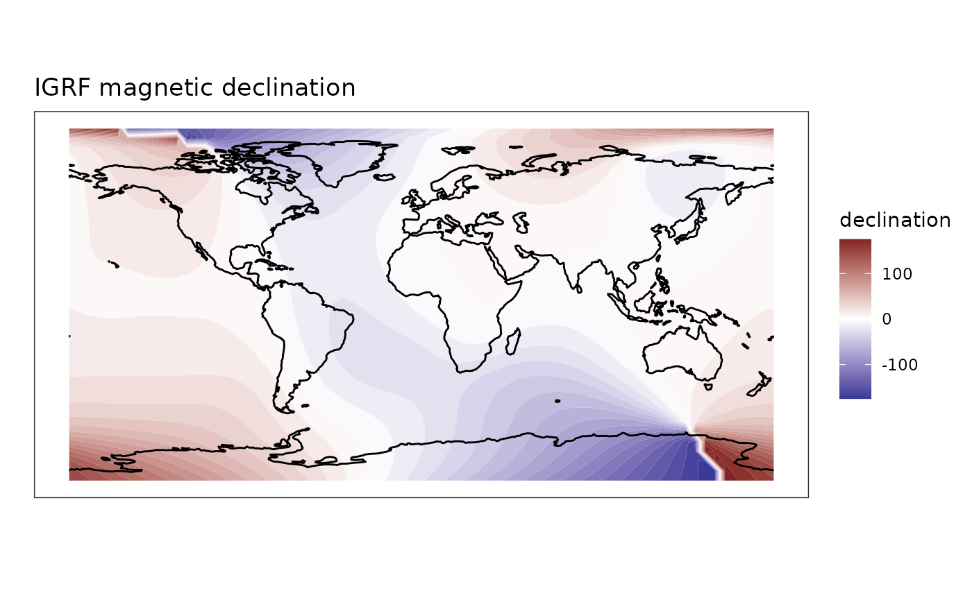
You may generate global maps of the IGRF using the igrf_grid() function, setting similar parameters as above while specifying a resolution as decimal degrees of the global grid. Keep in mind that values under 1 (fractions) will take an increasing amount of time and space to store the data.
grid <- igrf::igrf_grid(
  field = "main",
  year = 2000,
  altitude = 2,
  resolution = 5
  )
A resulting map can be generated from this data using contour lines from the metR package. The full code on how to generate the below figure is provided in the vignette.
Licensing
The igrf package is distributed under a AGPLv3 license, while the IGRF model code resides in the public domain (CC0) made available by Alken et al. (2021). I’m indebted to the the original authors for making model interoperability easy.
References
- Alken, P., Thebault, E., Beggan, C.D. et al. International Geomagnetic Reference Field: the thirteenth generation. Earth Planets Space 73, 49 (2021). https://doi.org/10.1186/s40623-020-01288-x